Democratic Republic of Congo

Independence DayJune 30, 1960
CapitalKinshasa
Major citiesKinshasa, Lubumbashi, Goma, Kisangani, Matadi, Mbuji-Mayi, Kananga, Bukavu, Kolwezi, Boma
Official languageFrench
Population90.794 million (2021)
Proven natural gas reserves66 billionm3 in the Lac Kivu
Proven crude oil reserves1,490,200,000 Barrels only in the Coastal Basin
Crude oil production22,000 bbl per Day (2022)
Gas production
Nominal GDPCF 119,540.82 billion (2022)
CurrencyCongolese FrancsCongolese Francs

Summary

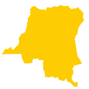
The Democratic Republic of Congo is a country in Central Africa. With an area of 2,345,409 km², it is the fourth most populous country in Africa, as well as the most populous French-speaking country.

The country shares its borders with the enclave of Cabinda (Angola) in the west-southwest; the Republic of Congo to the west; the Central African Republic in the North; South Sudan in the Northeast; Uganda to the East-North-East; Rwanda and Burundi in the East; Tanzania in the East-South-East; Zambia in the South-South-East and Angola in the South-West.

From 1980 to 1960, this former colony was called Belgian Congo, but also “Congo-Leopoldville”.

Several hundred ethnic groups make up the country’s population; French is the official language and four Bantu languages (Lingala, Kikongo, Swahili and Tshiluba) have the status of national languages.

The economy is mainly based on the primary sector (agriculture and mining).

The DRC is crossed by the equator, with a third of the country lying north of this line. The climate is hot and humid in the river basin region. It is dry and cool towards the South. In the south of Equator the rainy season lasts from October to May, and in the north it lasts from April to May. As for the level of Ecuador, it rains almost every day and the rate of precipitation is constant throughout the year. During the rainy season, thunderstorms are violent but last only a few hours. The average precipitation level is 107mm throughout the country with a breakdown into three climatic zones namely:

  1. Mountain climate, characterized by a precipitation duration of 9 to 12 months per year, and a temperature variation between 6 to 18°C. This climate is encountered in the Eastern part (City of Goma).
  2. Equatorial climate, characterized by a precipitation duration of 10 to 12 months per year, and a temperature variation between 25 to 28°C.  This climate is found in the central part of the Congo River Basin (City of Kisangani).

Humid Tropical climate, characterized by a precipitation duration of 5 to 6 months per year, and a temperature variation of 17 to 20°C. This climate is found in the southeastern part (City of Lubumbashi).

Jour de l’indépendance30 juin 1960
CapitaleKinshasa
Principales villesKinshasa, Lubumbashi, Goma, Kisangani, Matadi, Mbuji-Mayi, Kananga, Bukavu, Kolwezi, Boma
Langue officielleFrançais
Population90.794 million (2021)
Réserves prouvées de gaz naturel66 billionm3 in the Lac Kivu
Réserves prouvées de pétrole brut1,490,200,000 Barrels only in the Coastal Basin
Production de pétrole brut22 000 bbl par Jour (2022)
Gas production
PIB nominal119 540,82 milliards de FC (2022)
CurrencyCongolese FrancsFrancs Congolais

Sommaire

La République Démocratique du Congo est un pays d’Afrique centrale. Avec une superficie de 2 345 409 km², il est le quatrième pays le plus peuplé d’Afrique, ainsi que le pays francophone le plus peuplé.

Le pays partage ses frontières avec l’enclave de Cabinda (Angola) à l’Ouest-Sud-Ouest ; la République du Congo à l’Ouest ; la République Centrafricaine au Nord ; le Soudan du Sud au Nord-Est ; l’Ouganda à l’Est-Nord-Est ; le Rwanda et le Burundi à l’Est ; la Tanzanie à l’Est-Sud-Est ; la Zambie au Sud-Sud-Est et l’Angola au Sud-Ouest.

De 1980 à 1960, cette ancienne colonie était appelée Congo Belge, mais aussi « Congo-Léopoldville ».

Plusieurs centaines d’ethnies forment la population du pays ; le français est la langue officielle et quatre langues bantoues (le lingala, le kikongo, le swahili et le tshiluba) ont le statut de langue nationale. 

L’économie repose principalement sur le secteur primaire (agriculture et exploitation minière).

La RDC est traversée par l’équateur, avec un tiers du pays se trouvant au Nord de cette ligne. Le climat est chaud et Humide dans la région du bassin fluvial. Il est sec et frais vers le Sud. Au Sud de l’Equateur la saison de pluie dure de l’Octobre à Mai, et au Nord elle dure d’Avril à Mai. Quant au niveau de l’Equateur, il pleut presque chaque jour et le taux de précipitions sont constante tout au long de l’année. Durant la saison pluvieuse, les orages sont violents mais ne durent que quelques heures. Le niveau de précipitation moyenne est de 107mm dans l’ensemble du pays avec une repartie en trois zones climatiques à savoir :

  1. Climat de Montagne, caractérisé par une durée de précipitation de 9 à 12 mois par an, et une variation de température entre 6 à 18°C. Ce climat est rencontré dans la partie Est (Ville de Goma).
  2. Climat Equatorial, caractérisé par une durée de précipitation de 10 à 12 mois par an, et une variation de température entre 25 à 28°C. Ce climat est rencontré dans la partie Centrale du Bassin du Fleuve Congo (Ville de Kisangani).

Climat Tropical Humide, caractérisé par une durée de précipitation de 5 à 6 mois par an, et une variation de température de 17 à 20°C. Ce climat est rencontré dans la partie Sud-Est (Ville de Lubumbashi).


H.E. Félix Antoine Tshisekedi Tshilombo

BUDIMBU NTUABUANGA Didier

Ministre des Hydrocarbures

Mr. Dominique Wetshondo Osomba

Mr. Augustin NKUBA KASANZA

DG SONAHYDROC